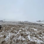

There are so many satellites up there these days that astronomers worry that they will block their view. And while some of these satellites can offer a new level of vegetation and crop image analysis, the uptake has been a bit slow so far.
Where there has been significant growth — and perhaps a window of opportunity — is in the launch of “resellers” — services that gather data on behalf of customers interested in obtaining imagery from all those satellites in orbit.
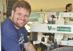
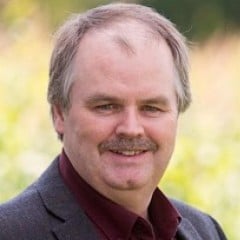
Ben Kovacs is a senior earth observation consultant with SkyWatch Space Applications. Although the company is headquartered in Kitchener-Waterloo, he’s based in Vancouver, B.C. SkyWatch is one of dozens of service providers creating background infrastructure for companies, accessing data for testing, prototyping and generating solutions for a client’s particular market. It’s a relatively new intermediate stage in the precision ag/imagery value chain, providing a level of information and detail that’s friendlier for end-users.
Read Also
How scientists are using DNA and climate data to breed crops of the future
A method for forecasting how crops will perform in different environments so that plant breeders can quickly select the best parents for new, climate-resilient varieties.
“We’re focusing on making Earth-observation technology easier and more accessible and also more affordable,” says Kovacs. “We’ve seen an increase in end-users and customers looking to build applications and monitor anything from powerline corridors to detecting vegetation encroachment on rights-of-way. In agriculture, we’re starting to see a lot of applications growing outside of the traditional markets of North America and Europe, so into South America, Asia and Africa as well.”
[READ MORE] Another digital option for farmers
In the past 24 months, the Earth observation technology sphere has been marked by a surge in acquisitions by companies and considerable resources flooding into the marketplace. New assets include availability of higher-res images (through the use of red-blue-green (RBG) and infrared technologies) which will create new layers of data information. Kovacs says that by year’s end, some hyperspectral systems are expected to hit the market, distinguishing different wavelengths to enable users to identify crops or variations in soil profiles and unlocking different ways to calculate biomass or assess disease outbreaks.
As access to hyperspectral technology continues to increase, so will the options available to growers and advisors. Then there’s radar technology, with thermal radar and hyperspectral imagery combined to provide crop-penetrating and ground-penetrating systems.
“The assets just need to be put up in space,” says Kovacs, noting that cost efficiencies for launching satellites have greatly increased. “Once they’re there, we can start to combine different data sources to build more effective models to be able to better understand some of these nuanced things we don’t fully understand.”
Next steps
As more resellers have entered the market, Aaron Breimer has found a small yet dedicated contingent of agronomists willing to expand their offerings by further specializing in imagery analysis. Historically, if someone wanted satellite imagery, they’d approach the large “constellation” providers such as Planet or Airbus.
It’s now evolved to where there are companies like SkyWatch which have arrangements with the constellation providers allowing them to pick and choose the depth of data. In the process, it’s become easier to access higher resolutions at a more reasonable price point. That’s creating the opportunity for that intermediate level of service providers such as agronomists who are committing more time and effort to be that information conduit, becoming a third stage after satellite technology providers and resellers and catering to growers.
[READ MORE] Precision ag needs and wants
This is where the precision ag sector is inching towards collaboration, which Breimer concedes is a difficult concept. But if someone could figure out how to create a collaborative ecosystem in agriculture, they would be highly sought after.
“True collaboration is something we’re still working on sorting out,” says Breimer, vice-president of data insights with Deveron, based in Chatham, Ontario. “Agriculture is still very fragmented and collaboration for a lot of people comes down to, ‘As long as you do it my way, I’ll collaborate with you … There are some amazing agronomists across the industry and I would love to work with more of them. To do that, collaboration is going to be the key and I’ve reached out to some of them, but a lot of them have a full plate already.”
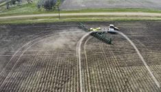
The science of getting the imagery hasn’t really changed — it can still be “clunky” as Breimer calls it — and the data files can be massive, given the land area that satellites cover (50 square kilometres equals more than 12,000 acres). And some growers and advisors still want control of the images of their fields, despite the inability of standard laptops to stitch the multiple images required for in-depth analysis.
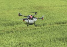
But the cost of fixed-wing or drone imagery has not decreased, which has opened the door for higher-resolution satellite imagery, complemented by more orbital units in space and additional options for detailed analysis (beyond RBG or near difference vegetation index (NDVI) filters).
The decision still comes down to value, the evaluation of which can be derived from several variables.
“My definition of value has always been, ‘Is the farmer willing to pay for it?’” says Breimer. “There are apps on the market that give you crop health maps — some are free, others you pay for other aspects of it. Or if it is free, they’re using it for other reasons. A lot of those apps allow growers to wirelessly transmit data between equipment — and that’s the value.”
The trick with satellite imagery is to get to the point where there’s an identified value that gets the grower into a field to ground-truth the information. It’s one thing to provide the image but Breimer insists we’re not to the point where growers are willing to pay for what they believe is an unproven service, no matter how well-steeped in science it may be. That’s why he’s convinced of the need for the well-trained, collaboration-minded agronomist or advisor: most growers already have enough on the go.
“Ultimately those are the people who are going to learn the technology or pass that technology out, and if it’s there, they’re going to assist farmers in being able to adapt to it.”
[READ MORE] Taking crop imaging to a new level
A giant flywheel
For Kovacs, the road ahead consists of critical mass and cost efficiencies. Like the world of computers, the more units, the lower the price. He believes that in a couple of years, the cost of data could be reduced between 10 and 100 times, based on assets going to space and the ease of obtaining the data. From there, it’s a matter of deriving the actions that generate the best economic results.
“It’ll be easier to have more diverse assets to collect more data for more customers, which acts like a giant flywheel, which we see as accelerating the supply and the demand,” says Kovacs. “It enables those data suppliers to carve out their own niche and we see them competing against each other and securing their corner of the market where they can be successful. That’ll reduce the costs and the barrier to access this imagery.”