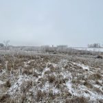
Reading Time: 4 minutes You can’t say it has been a strange and interesting winter. First, we saw a wintery end to October, then fall moved back in for most of November and December before we finally saw a big old shot winter in mid-January. Now we have been dealing with spring like conditions over the last two weeks – what’s next? Well, it looks like winter is going to try and make a comeback.
Prairie forecast: Stormy start in the east, slightly cooler west
Issued Feb. 7, covering Feb. 7 to 14, 2024
Prairie forecast: A little more heat, then slow cool down
Issued Jan. 31, 2024. Covers Jan. 31 to Feb. 7
Reading Time: 4 minutes The big question for this forecast period is whether these mild temperatures will continue, or we see a return to more seasonable mid-winter temperatures? All I can say is that spring isn’t quite here yet.
Prairie forecast: Warm weather returns
Issued Jan. 24, 2024, covering Jan. 24 to 31
Reading Time: 3 minutes For this forecast period, it looks like our weather pattern will undergo a shift back to the mild pattern we experienced at the beginning of the winter. It also looks like the warm weather will stick around for at least a couple of weeks. The million-dollar question is whether we will see another outbreak of cold arctic air, or will we see an early start to spring? Well, if I knew that answer to that, I would be rich, but I don’t think winter is over quite yet.
Prairie forecast: More typical mid-winter weather
Issued Jan. 17, covering Jan. 17 to 24
Reading Time: 3 minutes For this forecast period it looks like it'll simply be winter--not bone chilling cold, but not springtime warm. The general pattern that appears to be developing across the prairies is showing warm air trying to push northeastwards out of the western U.S., but with a northwesterly flow across the prairies, it looks like there will be a parade of cold, arctic high-pressure systems dropping southeastwards every few of days. The question is, just how far north will the warm air push, or for far south will the arctic air push?
Western Canada’s dry winter heralds worsening drought for 2024
Oil and gas, hydro, forestry, sports affected alongside agriculture
Reading Time: 3 minutes Canada's abnormally dry winter is worsening drought conditions across the western provinces, where most of the country's oil, gas, forest products and grain are produced.
Prairie forecast: Frigid temperatures moving in
Issued Jan. 10, 2024, covering Jan 10 to 17
Reading Time: 3 minutes Coldest temperatures look to be over the western prairies but there looks to be some relief from the really cold temperatures early next week. With cold arctic high pressure dominating, little in the way of snow is expected during this forecast period.
Prairie forecast: Winter temperatures moving in
Issued Jan. 03, covering: Jan. 3 – 10
Reading Time: 3 minutes Looking at this forecast period, the best way I can describe it is that we will be seeing a slow slide into more seasonal temperatures. The persistent upper-level ridging that brought warm--and record warm temperatures--to much of the prairies in December has broken down. The weather models are showing a trough of low pressure developing over the west coast over the next seven days.
Prairie forecast: One more week of above average temperatures
Issued Dec. 27, covering Dec. 27 to Jan. 3
Reading Time: 3 minutes As we head into a new year, it's looking like this could be the last mild forecast period before a switch to a more typical winter weather pattern.
As usual, there is always a fair bit of uncertainty in forecasts beyond seven or so days, but we all knew that at some point we'd see some cold wintery weather move in.
Prairie forecast: Mild and dry weather right through to the New Year
Issued Dec. 20, covering Dec. 20 to Jan. 1
Reading Time: 3 minutes The holiday weather picture is starting to shape up, and if you're hoping for a perfect Christmas day with falling snow, I wouldn’t get my hopes up. If you are hoping for a continuation of mild winter weather, then it looks like you are in luck.
Prairie forecast: Mild and dry weather right up to the holidays
Issued Dec. 13, covering Dec. 13 to Dec. 25
Reading Time: 3 minutes Here is the big picture: there are two current storm tracks across North America. The first, which is well to our north, is the storm track that would normally be across our region. So far this winter, it has been displaced to our north – one of the reasons we have been dry. The second storm track is well to the south across the southern U.S. This places us under a rather slack flow as we oscillate between pushes of warm and cool air with each passage of low-pressure to our north.