Forecast issued April 1, covering April 1 to 8, 2026
Highlights
Read Also

Farmers’ Almanac rescued from closure; fate of Canadian content unknown
The Farmers’ Almanac, which had said last fall it would cease publication at the end of 2025, will now continue under new ownership.
- Current indications are that a cooler-than-average weather pattern will persist for the next seven to 10 days.
- With no major systems expected to hit Alberta over the next week, much of the province will see relatively quiet weather. Sunny to partly cloudy skies are expected to dominate most days.
- From Wednesday through Friday, Manitoba and Saskatchewan can expect partly or mostly cloudy skies and the chance of occasional flurries.
Overview
The weather models had a fairly good handle on the overall pattern over the past week, but as is usual at this time of year, the finer details were a little off. What is perhaps more notable is how consistent the broader pattern has been, which has allowed models to perform reasonably well even further out. Over the past three to four weeks, there has been very little change in the large-scale setup, and that consistency looks to continue.
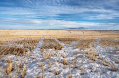
While temperatures will gradually trend upward as we move into spring, the overall cooler-than-average pattern remains firmly in place. Current indications suggest this will persist for at least the next 7 to 10 days.
- More weather coverage: Farmers’ Almanac rescued from closure
We begin this forecast period with high pressure firmly entrenched across the northern Prairies. Meanwhile, the main storm track is taking shape across the northern United States. This places much of the agricultural Prairies in a sort of in-between zone — caught between the dominant influence of northern high pressure and more active weather to the south.
The good news, depending on your perspective, is that most heavier precipitation events are expected to remain south of the border through this forecast period. The downside? Any significant early spring warmth will also stay to our south.
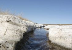
For areas still holding onto snowpack, this means the slow, gradual melt will continue rather than a rapid spring runoff.
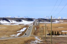
Alberta
With no major systems expected to hit the province over the next week, much of Alberta will see relatively quiet weather. Sunny to partly cloudy skies are expected to dominate most days.
That said, the models are tracking an area of low pressure that’s pushing in from the Pacific and cutting through Montana on Thursday into Friday. This system will likely bring increased cloud cover along with scattered showers or flurries to southern Alberta late Thursday. Central and northern regions can expect partly cloudy skies with the occasional flurry.
Temperatures will remain on the cool side through this period, with daytime highs generally in the 0 to 3°C range and overnight lows dipping to around -6°C.
Conditions should improve heading into the weekend as the Montana low shifts eastward and weak upper-level ridging builds into the province. This should allow for more sunshine and warmth with daytime highs rising into the 7 to 11°C range across most regions.
Looking ahead to early next week, the models suggest an area of low pressure developing over northern Alberta. This could bring increased cloud cover and periods of snow to northern parts of the province.
Farther south, a southerly flow ahead of the system may allow milder air to push in, potentially lifting daytime highs into the mid-teens. As has been the case with this pattern, confidence in this portion of the forecast remains low and will need to be monitored.
Saskatchewan and Manitoba
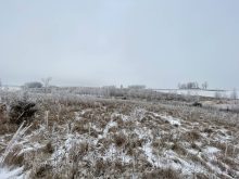
We begin the forecast period with a departing frontal system that brought anywhere from a light dusting of snow to upwards of 10 to 15 cm in some areas. In its wake, weak high pressure will attempt to build into the region, but conditions are expected to remain somewhat unsettled.
From Wednesday through Friday, expect partly to mostly cloudy skies and the chance of occasional flurries. Daytime highs will largely depend on cloud cover — generally hovering around the freezing mark under thicker clouds but climbing to around 5°C in sunnier areas.
Heading into the weekend, a more defined battle sets up between high pressure to the north and the active storm track to the south. This will result in a mix of sunny to partly cloudy conditions. Southern regions will likely see more cloud cover given their proximity to the storm track, while northern areas should benefit from increased sunshine.
- More weather coverage: Get farmers in on federal water security strategy planning, CFA says
Temperatures over the weekend are expected to reach around 5°C, which is near to slightly below seasonal averages for this time of year.
Early next week, attention turns to the potential development of a low pressure system over northern Alberta. If this system evolves as currently projected, it could draw milder air northward across the southern Prairies on Tuesday and Wednesday. This could push daytime highs closer to the 10°C mark.
Confidence remains low regarding the exact evolution of this system. Current model runs indicate the potential for another round of accumulating snowfall by midweek, likely in the Wednesday to Thursday timeframe, but details on track, intensity, and precipitation type remain uncertain.