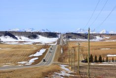

The weather regime across southern and central Canada is currently being dominated by a large sprawling surface high over eastern regions with a slowly digging trough of low pressure over the West Coast. The flows around these two features have been producing warm summer-like conditions across the eastern Prairies with slightly cooler conditions as you move west.
Over the last few days of May, the weather models show the eastern North American high slowly sliding further to the east while the western trough of low pressure will continue to deepen. While this is occurring, the unsettled conditions over the central U.S., which have been triggering showers and thunderstorms across Saskatchewan and western Manitoba late last week and into the weekend, will strengthen and being to push eastward. This will result in the eastern half of the Prairies continuing to see well above average temperatures with increasing chances of showers and thunderstorms. Over the western half of the Prairies the digging trough of low pressure will result in near average temperatures as cool air slides southward. The colder air moving in aloft will create unstable conditions which will lead to widely scattered showers and thunderstorms.
Read Also

Farmers expected to boost canola area beyond Statistics Canada intentions report
Canadian farmers might plant more canola acres than the 21.8 million that Statistics Canada reported in its seeding intentions report released on Thursday morning, analysts told Reuters.
— Daniel Bezte is a teacher by profession with a B.A. (Hon.) in geography, specializing in climatology from the University of Winnipeg. He operates a computerized weather station near Birds Hill Park, Man. Contact him via email with your questions and comments.