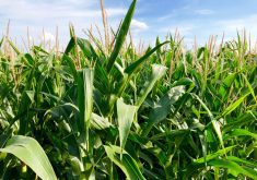
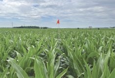
Have you ever wondered why crops don’t seem to do well on a certain bit of land and it’s not always obvious why? Angela Bedard-Haughn is here to help you figure that out.
The professor of soil science in the College of Agriculture and Bioresources at the University of Saskatchewan is leading the Saskatchewan Soil Information System (SKSIS), a phased research project that aims to know everything there is to know about that province’s soil resource and make that data accessible to farmers.
Phase 1 entailed the development and launch earlier this year of the SKSIS digital platform — a website where all the existing information on Saskatchewan’s soils, collected mainly by government agencies throughout the 20th century, is stored and fully searchable.
Bedard-Haughn says the site is intended to be used by farmers, researchers, agronomists, consultants, students — anyone with an interest in or need for knowledge about soils in a specific region, so that they can understand better what’s happening on the ground — literally.
“Part of what we were hoping to provide is a tool to allow people to understand why a piece of land isn’t producing” she says, adding the site can be used to investigate things such as soil texture, salinity, pH and much more. “So far, it’s going really well,” she says. “The feedback we’ve had has been really positive.”

While SKSIS-1 has successfully gathered the fragmented historical soil record into one place, Bedard-Haughn isn’t done. With funding from WGRF, SKSIS-2 aims to build on this framework to refine and expand the information, to find digital avenues for greater flexibility and share-ability, and to make it a true digital farming tool for the modern age.
“There are two main things we want to do,” she says. “The first is to enhance the current information.” To understand this, you need to zoom in on the SKSIS website until you start to see the irregular shapes that form the boundaries of different soil polygons.
“When they did the original soil surveys, they did it quarter section by quarter section,” says Bedard-Haughn. They then looked at which groups of soils commonly occurred in association with each other and then mapped those associations as polygons. This means the polygons are a little clunky by today’s precision agriculture standards for soil information. Sometimes a quarter section might be mapped as a single polygon, which itself might encompass three or more soil types.
Read Also
Agronomists share tips for evaluating new crop products and tech: Pt. 3
With new products, new production practices and new technology converging on the agriculture industry at a frenetic pace in recent…
To get from the current polygons to a more refined type of mapping that better reflects within-field variability, one big information gap is a lack of high-quality topographical information.
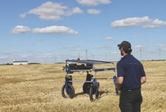
“We’re trying to come up with a method where farmers can input their own information, such as surface maps, soil test results and the like, and get back refined data of their own,” Bedard-Haughn says. “We couldn’t have imagined at the time the polygon maps were developed that precision farming would be at the level it is now.” In other words, knowing everything there is to know about every square metre of soil is information that can actually be used to good effect with today’s precision ag equipment.
One-stop shop
The second main focus of SKSIS-2 is to enhance the way new soil data is shared — “So that researchers and, wherever possible, producers, don’t spend so much time reinventing the wheel,” Bedard-Haughn says. Given how long this land has been farmed, researched and documented, it’s highly likely that someone has literally gone over the ground before and made notes. “Some things don’t change too much over time, like texture, so if another researcher goes to an area five years later and tests again, not knowing that information already exists, it’s a waste of time and resources.”
The trouble is that not all of these records are in one place. By providing a venue to share that information, with the appropriate checks and balances in place to ensure privacy as needed, the soil database gets richer, deeper and more useful.
To be sure, the goal is to document much more than things that stay relatively static. “There’s increasing interest in monitoring things like carbon, for example, to see patterns of change over time as they relate to climate or production,” Bedard-Haughn says. As well, infrastructure and events related to resource extraction, such as boreholes and spills, or natural events, such as fires and floods, all have an impact on soil productivity and can be noted in the SKSIS database to help develop high-resolution maps of soil characteristics so that farmers can better determine why a certain situation exists in their fields, which is the first step toward fixing it.
“I would love for farmers to be able to use this system to gradually improve the data available on their land,” Bedard-Haughn says. “They can bring yield and quality information into it and really understand how this land responds year over year, so precision ag means something.”
To that end, the SKSIS system was built using open-source software, making it fully accessible and useable by anyone. The more robust the data becomes over time, the more useful it is. “I want farmers to better understand the land they’re working, that’s their baseline,” Bedard-Haughn says. “To manage soils effectively, you have to understand them.”
The Western Grains Research Foundation (WGRF) is a farmer-funded and directed non-profit organization investing in agricultural research that benefits producers in Western Canada. For over 30 years the WGRF board has given producers a voice in agricultural research funding decisions. WGRF manages an endowment fund and the wheat and barley variety development check-off funds, investing over $14 million annually into variety development and field crop research. WGRF brings the research spending power of all farmers in Western Canada together, maximizing the returns they see from crop research.