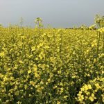
The description of Cory Willness’s canola field near Naicam, Sask., this year could fit hundreds of others across the Prairies. It has variable topography with too much moisture in the depressions. The topsoil on the knoll is poorer because of erosion over the years.
“We also had had some establishment problems along the top this year due to some wind damage,” Willness said in mid-July. “So the yield potential is not huge this year at the top or bottom. In the mid-slope areas, however, the crop establishment and crop health is fantastic and we’ve determined there is ample plant-available moisture in the soil in that zone, so we’re going ‘all in’ there and targeting 80 bu./ac.”
Read Also
Agronomists share tips for evaluating new crop products and tech: Pt. 3
With new products, new production practices and new technology converging on the agriculture industry at a frenetic pace in recent…
Because the mid-slope areas had high biomass and the plants were susceptible to sclerotinia, Willness applied full-rate fungicide in that zone. He used lower rates on the knoll and in the depressions where the crop was poorer, as the canopy was quite open and fungal infection was not a threat. He used none at all in the poorest areas.
On the mid-slopes, he top-dressed fertilizer at 15 gallons, and at 10 gallons on the hills and depressions, expecting yield in these poorer areas to be 45 to 50 bu./ac.
Giving it a SWAT
Willness is following the principle that the best place for inputs is where there’s enough moisture for the crop to respond.
To determine where that moisture is located, he’s using SWAT (soil, water and topography) mapping, which incorporates elevation, soil electrical conductivity data, water modelling and soil surveys.
Willness has been developing the technology since before 2003 when he opened his company, CropPro. It hired its first employee in 2008 and now has a staff of 30. He also co-owns Croptimistic Technology, which has partnerships with several agronomy firms on the Prairies and in Ontario and the Maritimes to offer SWAT mapping to other growers.
“Creating SWAT maps requires specialized hardware and it’s highly technical, so we only work with partners we trust,” Willness says. “It’s a learning curve and a slow process and our partners only offer these services when they are fully ready.”

Last year, CropPro, Croptimistic and South Country Equipment started the “SWAT Intelligence Project.” A total of 10 field sites, each already SWAT-mapped, were outfitted with rain gauges, and digital soil moisture probes were placed in the knoll, mid-slope and depression areas. Each probe has a solar-powered modem that transmits data wirelessly to the CropPro server, and readings are verified for accuracy.
Croptimistic then created three types of water maps. One shows infiltration — how well a field will absorb rain; another measures the field’s ability to hold plant-available water, and the third measures crop-available moisture.
Growers can access these maps through the associated free “CropRecords” app to determine if it’s appropriate to add fertility in-season, if fungicide should be applied, or both — and if so, exactly where.
“It’s easy to measure rainfall but you need to know what’s in the soil in order to make the best in-season input decisions,” Willness says. “That’s what you get with these SWAT Intelligence maps by field zone. For example, in my test field right now (mid-July), I have a month’s worth of plant-available soil moisture on the mid-slopes and so I’m going all in there to target a huge yield.”
Probes installed after seeding
While Willness advises three probes per field (in the knoll, mid-slope and depression), he says soil moisture in the knoll and depression can be extrapolated with the SWAT map data with only one probe on the mid-slope. Farmers purchase the probes from South Country. CropPro installs them after seeding and removes them after harvest. Soil moisture data from the probes is used to update the SWAT Intelligence maps every three days.
Willness says it’s becoming more common for Prairie farmers to measure soil moisture with probes. “It’s gone from none two years ago to now there are a couple of thousand probes in fields in the Prairie provinces, but that’s still a very small percentage of fields.”
For CropPro’s SWAT mapping, the initial cost is $8 to $12 per acre. Each year’s associated precision ag prescriptions (for seeding rate, fertility planning, soil sampling and two “zone checks”) cost $3 to $4.50 an acre.
As part of the refinement of the SWAT Intelligence system, 15 growers, who already have CropPro SWAT mapping completed and South Country moisture probes in place, get free SWAT Intelligence maps which indicate water-holding capacity, available water and days to critical moisture. Willness says future fees for these maps will be nominal.

While he says it’s impossible to give an accurate payback timeline for a given farm without many types of details, he provides a sample scenario.
“If a grower has 5,000 acres of wheat and SWAT map prescriptions result in improved grades due to reduced fusarium, the system pays for itself 10 times over in one year,” he says. “If you are a seed grower who obviously wants extremely uniform growth, the mapping will direct you on what to do in different areas of the field to make that happen.”
Willness stresses that the benefits of the system accrue over time.
“You don’t get the SWAT mapping done and put in the soil moisture probes and come out of the gate with perfection of crop management. It’s a matter of coming out of the gate with much more knowledge and from there, you start refining and using more precision.
“The big costs — and the big savings potentials with SWAT mapping — are variable-rate seeding and fertilizer application at planting. Fungicide and in-season fertilizer are lesser costs but can make a difference, as in my case this summer, with huge yield I am targeting for canola on my mid-slopes. Really, the only way to absolutely quantify ROI and see if you are doing the right thing compared to what you would have done without the system is to use strip trials.”
Willness says it’s inevitable that SWAT Intelligence water models will become common.
“If you compare growers with no SWAT map and no soil moisture data from probes to those that do, it’s a drastically higher level of knowledge for the latter group that will result in better ROI on inputs, higher potential yields and also long-term improvements in field consistency.
“Growers obviously want to apply inputs to get the biggest bang for their buck and not waste anything. This integration of technologies makes that possible.”


