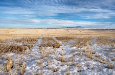
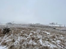
Faced with “significant” rainfall, parts of southern Alberta and downstream jurisdictions have again been bracing for late-spring flooding.
The province said Wednesday it’s moving “pre-emptively” to co-ordinate responders and has activated its 24-hour provincial emergency operations centre.
“Thankfully, the flood threat we are seeing this year is not as severe or widespread as what we experienced in 2013, but we know some people and communities have already suffered damage or may in the days ahead,” Premier Dave Hancock said in a release.
Residents, he added, are “fortunate that we did not get the amount of rain expected yesterday and we were able to downgrade some of the advisories this afternoon.”
Read Also
Prairie forecast: Warm start then cooler air to move back in
While spring appears to be gaining a foothold across the western Prairies, it continues to struggle across the eastern regions. This forecast period looks milder than the last, but weather models are still not showing a clear or sustained shift toward a more spring-like pattern.
Faced with rising levels on the Oldman, St. Mary, Belly and Waterton rivers, the Blood Reserve No. 148 evacuated starting Wednesday.
High water level alerts were in effect Wednesday evening for communities including Coalhurst and the MD of Willow Creek.
As of Wednesday afternoon, a flood warning was in effect for the South Saskatchewan, Waterton and Belly Rivers, Willow Creek and tributaries of the Crowsnest River. Remaining streams in the Oldman River basin were downgraded to “flood Watch” while tributaries flowing out of the Cypress Hills were downgraded to “high streamflow advisory.”
An overland flooding alert was issued for Claresholm on Wednesday, citing “a large amount of water travelling across land… leading to localized flooding,” but the Alberta Emergency Alert website now reports that alert is no longer in effect.
“Still significant”
Saskatchewan’s Water Security Agency reported Wednesday it’s also monitoring the rainfall and runoff events in southern Alberta. Where the 2013 flooding hit the Bow River basin, this week’s event is mainly in the Oldman River basin, and both rivers flow into Saskatchewan by way of the South Saskatchewan River.
Based on Alberta’s estimates Wednesday, the Saskatchewan agency said it expects flows on the South Saskatchewan “could be less” than what was seen last June “but still very significant” depending on how much rain has fallen, where it falls and the timing of tributary flow.
Flows were expected to increase at the Alberta/Saskatchewan border early Thursday, with inflows to Saskatchewan’s Lake Diefenbaker expected to peak this weekend. The agency said it will use “any available storage capacity below the full supply level” in the lake to keep outflows from swamping channels further downstream.
The agency said it began increasing flows from Gardiner Dam on Tuesday to further free up storage in the lake for flood protection.
Alberta’s rains this week aren’t expected to raise flows on the North Saskatchewan River, the agency added Wednesday. — AGCanada.com Network