
Our overall weather pattern has definitely undergone a shift over the last week or so. The problem is that it’s not a stable pattern, which means a tough couple of weeks of forecasting.
We’re seeing periodic troughing develop along the West Coast. This places us in a southwesterly flow. Areas of low pressure then spin up in the flow and lift northwards. Over to the east, there continues to be high pressure locked in place which is making it difficult for the western low to push eastwards. Instead, the lows lift to the north or northeast before sliding east over the northern Prairies. The slow progress of these lows allowed for plenty of moisture to move northwards. This moisture has been feeding the development of late season thunderstorms.
Read Also

Pulse Weekly: SaskPulse optimistic despite input, crop price concerns
SaskPulse executive director Carl Potts is optimistic ahead of the planting season despite lower crop prices and the war in Iran.
Typically, with this type of setup, the slow motion of the low allows it to pull moisture, warm up from the south and, as the lows lift northwards, they will tap into cold air and push it southwards. So far, we have not seen much of this. Colder temperatures have only made it to the far northern Prairies. The weather models keep hinting at this cold air plunging southwards before pulling back their predictions.
This forecast period starts with one of the northwestern U.S. lows slowly lifting northwards. The unsettled weather that started the week across parts of Saskatchewan and much of southern Manitoba looks to continue. It appears the low will only move out late Friday or early Saturday. Even parts of southern Alberta my see some rainfall from this low on Wednesday.
Over the weekend and early next week, it looks a bit more like fall like across the Prairies as cooler air tries to work southward behind the departing low. The coolest readings look to be over the northern half of Alberta and Saskatchewan. The southern Prairies will likely see slightly above average temperatures. The weather models are then showing another area of low pressure developing around mid week, but this time further north over Alberta. Considering the pattern we are in, there’s a good chance of seeing more unsettled weather during the second half of next week.
Alberta
As mentioned, a developing Montana low will bring the chance of showers on Wednesday to parts of southeastern Alberta, while areas to the west and north should see sunny to partly cloudy skies. Temperatures look to be seasonably mild with daytime highs in the upper teens and overnight lows falling to around 7 C.
A couple of weak disturbances are forecasted to ripple through the province, with the first one expected on Friday and the second around Monday. These systems will bring a mix of sun and clouds and the chance of a few showers. Temperatures will continue to be seasonable with highs in the mid to upper teens and overnight lows in the 5 to 8 C range.
A stronger area of low pressure if forecasted to come ashore over central B.C. and to help spin up a lee side low over central Alberta around Wednesday. The southerly flow ahead of this feature should help to moderate temperatures. Daytime highs are forecasted to be in the low twenties with overnight low falling to around 12 C. This low will likely bring more precipitation during the second half of the week to central and northern regions.
Saskatchewan and Manitoba
Both regions are going to have to deal with at least a couple more days of unsettled weather. The main Montana low will lift northeastwards through southern Saskatchewan on Wednesday and into northern Manitoba by Friday. There will be plenty of moisture and warm air in place for more thunderstorms. The best chance of storms is over Saskatchewan on Wednesday, with a slightly lower chance of thunderstorms over Manitoba later Wednesday and Wednesday night.
The low will slowly lift northeastward which will result in cloudy skies and scattered showers on Thursday. Skies should start to clear out over Saskatchewan early on Friday with Manitoba clearing out later in the day. Despite the clouds and showers, temperatures look to be seasonable with daytime highs in the low twenties on Wednesday, falling to around 20 C mark on Thursday. Expect overnight lows to remain mild.
Over the weekend and into the first half of next week, the weather models show a couple of weak systems rippling across the Prairies. These are predicted to bring a mix of sun and clouds and a few showers. The exact timing of these systems will be a bit difficult. The first system is forecasted to drift through on Saturday and the second system on Monday or Tuesday.
With the clouds and showers, expect daytime highs to be in the upper teens with overnight lows falling to around 10 C.
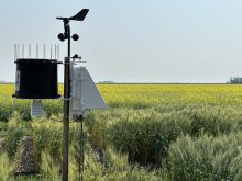
— Daniel Bezte is a teacher by profession with a B.A. (Hon.) in geography, specializing in climatology from the University of Winnipeg. He operates a computerized weather station near Birds Hill Park, Man. Contact him via email with your questions and comments.