
The last forecast played out pretty close to what the weather models were predicting, with one small deviation: temperatures ended up being about 2 to 4 C warmer than forecasted. This will be something to keep in mind as we look at this week’s forecast.
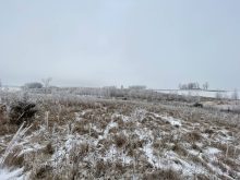
The forecast is looking rather quiet for this time of the year. November can often bring big storms as the weather pattern shifts from fall to winter, but it looks more and more like this winter is shaping up to be an El Nino winter, at least to start. Looking at the big picture, there is a large low sitting over far northeastern Canada that is expected to move westward toward northern Hudson Bay. All indications are that this low will stay far enough to the east as to have little to no impact on Western Canada. Off the West Coast, the storm track is keeping or pushing areas of low pressure well north into the Gulf of Alaska. Between these two features — or across the Prairies — it looks like we will see weak high pressure in place for most of this forecast period. This means a continuation of above-average temperatures, will little chance of any significant precipitation.
Read Also
Prairie forecast: Arctic air dominates the forecast
For this forecast period, it appears we will need to wait a little longer for spring to arrive. Weather models continue to show a northwesterly flow across the region, but this time the dividing line between mild and cold air has shifted slightly farther south. As a result, near to below-average temperatures are expected across much of the Prairies.
Alberta
It looks like there will be no strong systems impacting Alberta during this forecast period; weak high pressure will be in place for most of it. This should bring sunny to partly cloudy skies on most days with daytime highs starting off right around the 0 C mark. It does look like some arctic air will try to push southward on Thursday and Friday, dropping temperatures down by a few degrees in the south, with the Peace River regions seeing highs drop down into the -7 to -10 C range.
Over the weekend, far western and southern regions could see some flurries or light snow as a disturbance pushes in from the Pacific. The weather models show this system weakening and dropping to the south by Monday. By Tuesday or Wednesday, the weather models are showing a stronger system pushing eastward into the southern Yukon. The southerly flow ahead of this system will push temperatures well above average with daytime highs across the southern half of the province possibly making it into the low teens with low single digits farther north.
Saskatchewan
This region looks to see nice quiet early winter weather with no strong systems impacting the region. With weak high pressure in place expect sunny to partly cloudy skies with daytime highs in the -5 to -2 C range. More northern regions might see slightly cooler temperatures on Thursday and Friday as arctic air skirts the region, but by the weekend temperatures should warm back up. There could be a few flurries on Thursday as the colder air tries to push southward but amounts look to be minimal.
With a slack pressure pattern, expect light winds for most of this forecast period. Combine this with sunshine and mild temperatures and it looks like it will be very nice start to December. Near the end of this forecast period, the weather models show a push of mild air moving into the province from the southwest, pushing daytime highs back toward or even above the freezing mark.
Manitoba
Manitoba’s forecast is very similar to Saskatchewan’s. A weak pressure pattern should result in sunny to partly cloudy skies and light wind. This, combined with above-average temperatures for most of this forecast period, should result in a really nice start to December. It does look like there will be a bit of a cooldown from Thursday through to Sunday as cooler air tries to push southward around the low over northern Hudson Bay, but even these cooler temperatures will be right around average for this time of the year with daytime highs expected to be in the -2 to -5 C range.
To start the first full week of December, the weather models show a slow warming trend as mild air pushes in from the west. Expect daytime highs to warm toward the 0 C mark by Wednesday or Thursday with overnight lows only falling to around -8 C.
— Daniel Bezte is a teacher by profession with a B.A. (Hon.) in geography, specializing in climatology from the University of Winnipeg. He operates a computerized weather station near Birds Hill Park, Man. Contact him via email with your questions and comments.