It looks like our unsettled weather pattern is going to continue for a little while longer. A broad but unorganized area of low pressure impacts all three Prairie provinces for at least the first half of this forecast period. Unsettled weather means it will be a difficult forecast to pin down. It also means seasonable temperatures with no big intense heat waves expected—though that doesn’t mean we won’t see a few hot days.
We start this forecast period with a cool area of high pressure over the eastern Prairies stretching into Ontario. To the west, there’s a trough of low pressure off the West Coast with weak ridging trying to build over Alberta. The West Coast trough is forecasted to push inland. This will help spin up several areas of low pressure stretching from the Yukon down into the northern states.
Read Also

Canada, India team up on new pulse protein centre
Saskatchewan announced in a press release on March 3, 2026 it will team up with India on a proposed new pulse protein centre of excellence north of New Delhi.
This muddled area of low pressure is forecasted to track eastwards across the Prairies during the first half of this forecast period. The final instability and unsettled weather is expected to leave Manitoba on Sunday.
The weather models then show a weak but broad upper ridge building across the Prairies as we move towards Canada Day. This ridge should bring sunny skies and warm temperatures to all three provinces on Monday and Tuesday. The weather models then show another large and disorganized area of low pressure developing across the Prairies on Wednesday, but that is along way off and confidence in this particular system is low.
Alberta
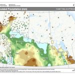
It looks like a coolish and unsettled start to this forecast period as a trough of low pressure pushes into the region from the west. There’s no clear area that will be the main focus for precipitation. Rather, it looks like conditions will bring scattered showers and occasional afternoon thundershowers or storms to most regions from Wednesday to Saturday.
Temperatures will be a bit on the cool side thanks to the clouds and showers. Expect daytime highs to be in the 20 to 23 C range with overnight lows falling into the 9 to 12 C range.
By Sunday, skies should clear out and temperatures will begin warming up as a weak upper-level ridge begins to build across the region. Expect plenty of sunshine and daytime highs in the 24 to 26 C range with overnight lows in the 12 to 15 C range. There’s a chance of some showers or thundershowers on Wednesday as the weather models are showing another weak trough of low pressure pushing in off the Pacific. Confidence in the timing of this feature is low.
Saskatchewan and Manitoba
The first half of this forecast period looks to see fairly textbook summer weather across these two provinces. A region of high pressure is slowly sliding to the east to be replaced by a broad and unorganized region of low pressure. This will bring sunny to partly cloudy skies to most regions with the chance of afternoon and early evening showers and thundershowers. The best chance for precipitation looks to be on Thursday over Saskatchewan and then late day Friday and early Saturday across Manitoba. Amounts look to be light but heavier thundershowers could drop a quick 10 mm in some regions.
Temperatures look to be warm thanks to a southerly flow ahead of trough of low pressure. Expect daytime highs in the mid-twenties and overnight low falling into the low to mid teens.
Most of the unsettled weather should be out of Saskatchewan by Saturday and out of Manitoba by midday Sunday. Upper-level ridging is then forecast to begin building in which will bring plenty of sunshine and warm temperatures for Canada Day. Expect daytime highs in the mid to upper twenties on Monday and Tuesday with overnight lows falling into the mid teens.
The weather models then show another broad and unorganized area of low pressure pushing into Saskatchewan on Wednesday and Manitoba on Thursday, which would bring a return to partly cloudy skies with afternoon and evening showers and thundershowers. As usual, confidence in this last part of the forecast is low.


