An old cartoon shows two scientists standing at a ship’s rail, gazing out over the beauty of the horizon. In a reflective moment, one extends his arm, motions to the setting sun and says to the other: “Ever thought about all that data out there just yearning to be processed?”
Substitute a couple of modern precision farmers and you’ve got the core of what drives Canada’s newest production system, which is all about land and the collection, manipulation, and interpretation of the data it generates.
Read Also
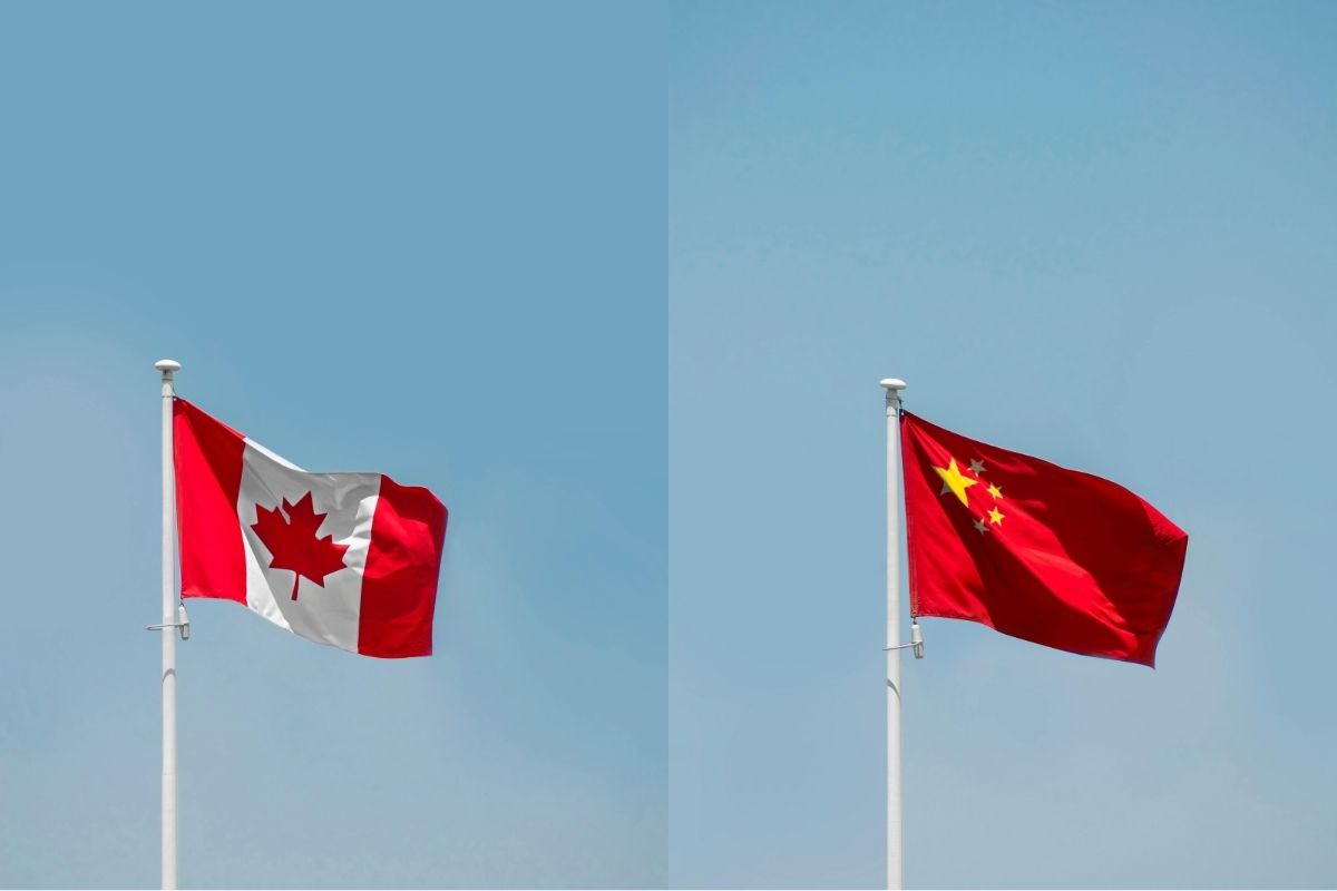
Ask a Lawyer: What the Canada-China trade deal means for farmers
A Canada-China preliminary trade agreement reduces tariffs on canola seed, canola meal and peas, but some tariffs remain unchanged, leaving gaps for producers.
“Precision agriculture is about the need for more and more control in farming through a confluence of measurement and computing,” says Mike Duncan, industrial research chair at Niagara College in Ontario. “The single most important trigger was the yield monitor introduced in the mid-’90s.”
Duncan says that the idea of the yield monitor was hatched earlier than that, and it would probably show up in a review of 1980s engineering journals. That sort of thing is typical in the development of any technology. There’s always a time lag between the idea and the execution.
Once in place, the GPS-based yield monitor proved that farm yields aren’t uniform because fields aren’t uniform. Farmers have always known that some fields produce better than others, and that there’s something about the soil composition and topography that affected how a crop grew there. For thousands of years farmers have developed that understanding through observation and experience.
The new science of ecology started looking at these things in terms of spatial systems, studying how different communities of plants interact with soil and how they interact with each other. Over the last 50 years we’ve learned how to measure those interactions and, by examining all those different components, we’ve gained greater understanding of how we can use farm ecology to our advantage. The sheer size of the North American farm makes it necessary. The financial cost of inputs and the environmental costs of wasting them makes it essential.
“Knowing these things gives us more control in a positive sense,” Duncan says. “It gives you a measure of control of the environmental and land stewardship aspect of farming which reflects on the business side, a fiscal responsibility in terms of not overfeeding or underfeeding the crop.”
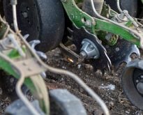
Farmers also used chemistry, adjusting their fertilizer rates based on a soil-testing program. The assumption was that spot samples would reveal an amount that should be applied at a constant rate to the entire field. The problem is that soil really doesn’t behave that way, and the blanket application could be underdosing some areas while overdosing others. Duncan tells of Rick Willemse of Yellow Gold Farms in Ontario who, when faced with an input price squeeze a few years back, came up with an ingenious program of variable-rate application.
“In 2008, the Chinese were cornering the potash market and he had to figure out how to shave $100 an acre off his fertilizer bill,” Duncan says. “He developed full-on, variable-rate precision agriculture at a time when there wasn’t any machinery to deliver it. Being a master machinist, he created his own spreader. He drew his map on his computer and then figured out where he was using GPS. He sat in the cab and he pulled this lever and pulled that lever based on where he was on his map.”
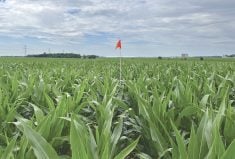
Willemse has been refining the technique ever since. He divided his fields into a series of 40-foot cells and mapped them on his computer. Records for each cell show his input levels and the yield that he got as a result. From experience, he has adjusted his inputs so he knows how to manage each cell to make best use of them.
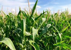
“His home west field right next to his house has about 5,000 cells in 44 acres, and if you walk out with a hand-held GPS he can tell you which of those cells you’re in and how profitable this part of the field is versus that part. I mean you’re sitting there saying, well, all I can see is corn, but he’s got full control over what’s going on and how much is coming out of each of those cells.”
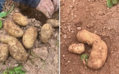
Another thing Willemse has found is that some parts of the field aren’t going to respond well to inputs no matter what he does. One section would only yield about 30 bushels per acre. His first reaction was to blast that patch with nitrogen, but it made no difference. The yield stubbornly stayed low.
“He sampled, and it turns out it was all sand so the nitrogen rapidly went away,” Duncan says. “He needed to do something else to bring up the organic matter content so year by year by year he’s been slowly remediating that area because it’s never going to produce unless you fix it, if you can fix it.”
Shortly after that the technology caught up and it’s now available so farmers and agronomists all over the world can put the same ideas to work. Any field can be mapped and divided into management zones based on input and yield data.
The yield monitor is one cog in the larger machine. The next is the Global Positioning System or GPS. This is a popular piece of navigation technology with a system of satellites that we use to locate a point on Earth with accuracy to within metres. This is made even more accurate when it’s bumped up with RTK.
“RTK is just a really precise form of GPS,” Duncan explains. “It’s called Real-Time Kinetic and what it is it takes DGPS (differential GPS) measurements as fast as it possibly can. The more measurements you can take and the faster you can take them makes the device able to position you within millimetres horizontally and several millimetres vertically.”
This means that, with a receiver on your combine, you can feed your location into a computer, and the computer can draw a map that shows exactly where the machine was and what the yield was at that point. Given several years of data, that map will show how each cell within that field will yield.
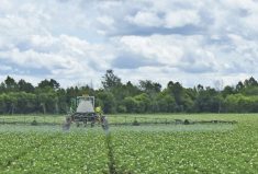
You can put the same GPS receiver into a tractor or a sprayer that can measure how much seed or pesticides have been applied and exactly where. Again, over a few years the patterns start to emerge and farmers can use these to regulate their inputs to get the best bang for their buck.
Another survey tool that we’re starting to see in agriculture is the farmer’s eye in the sky. Up until now farmers have made use of aerial photography or remote sensing imagery from satellites, but this kind of surveying was expensive and not always accurate. The new platform is the Unmanned Aerial Vehicle or UAV. A small aircraft carrying a camera may be sent aloft and, following a preset course, can produce a mosaic shot of the field. Using straight cameras or NDVI (Normalized Differential Vegetation Index), agronomists and farmers can produce even more useful data to help reduce the guesswork and, by extension, reduce the risk.
It’s thinking along the lines of legendary hockey player Wayne Gretzky, who understood the overall patterns of the game to the point where he intuitively sensed where the puck was going. Instead of chasing it he played a more proactive strategy by intercepting it. He knew where it would be so he’d get there first. He gave himself greater control of his game.
“It actually gives you absolute control,” Duncan says. “You know exactly which parts of your field are producing and if you do the analysis you can figure out your probable production based on past performance. You might have a drought year in which case all bets are off, but given that your crop behaves roughly the way it did last year or on the average for all the years that you have, you can figure out which areas are profitable and which ones are not.”